Enhanced Road Network Data from Overhead Imagery
This Project is no longer active.
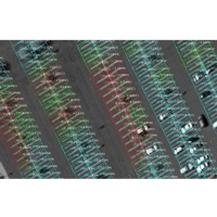
Digital maps are an essential resource for navigation by both autonomous and human driven vehicles. Digital maps are information rich but this information is difficult for an autonomous system to extract. Our initial research applies hierarchical image processing and machine learning techniques to extract a compact representation of parking lot geometry.
Displaying 6 Publications