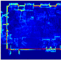
One reason for scanning a facility with laser scanners is to create blueprints of the as-built conditions. Blueprints primarily consist of 2D projections onto the floor (known as plan views or floor plans) or onto vertical planes (known as elevation views). Currently, it is possible to manually label the walls, doors, windows, and other entities that go into a floor plan model, but the process is time-consuming and labor-intensive. In this research, we are investigating methods to use point clouds to automatically estimate the location and extent of walls in a building, thereby creating an accurate floor plan. While many researchers have developed methods to make maps of building interiors (using robots, for example), the motivation in those cases has usually been to support robot navigation, with less of an emphasis on accuracy. Our work, in contrast, is focused on obtaining the accuracy needed for blueprint-quality floor plans, and we have developed objective measures to evaluate the accuracy of our method as well as other methods that are developed in the future.
This project is funded in part, by the National Science Foundation (CMMI-0856558) and by the Pennsylvania Infrastructure Technology Alliance.
current head
current staff
past staff
- Brian E Okorn
past contact
- Brian E Okorn
